

About Our
Geographical Location
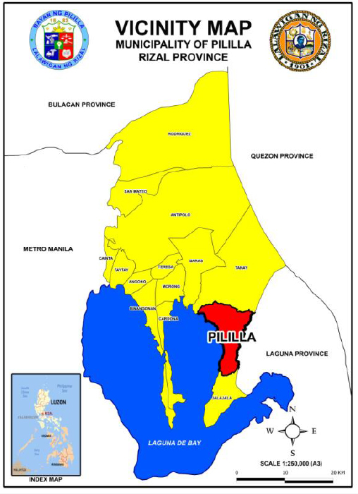
The municipality of Pililla is located between 121º 15′ 00″ and 121º 15′ 25″ east longitude and 14º 30′ and 14º 25′ north latitude. It is bounded by the town of Tanay in the north; the towns of Sta. Maria and Sta. Maria and Mabitac, Laguna in the east; Jala-jala, Rizal in the south and Laguna de Bay in the west.
Municipality of Pililla
Founded
1583
Classfication
First Class Municipality
Distance from Manila
53 Kilometers
Boundaries
Tanay (North), Laguna (East), Jala-jala (South) and Laguna de Bay (West)
Land Area
8, 218 Hectares
Barangays
9 Barangays
Population (2015 Census)
64, 812
Population Density (2015)
790 per Square Kilometer
General
Municipal Information
Pililla is a first class municipality in the Province of Rizal and is also known as its Green Field town. Originally established as an agricultural lakeshore locality, Pililla later became known as the host of the Malaya Thermal Power Plant and Pilipinas Shell’s Bitumin Plant. These major industrial facilities which were established in the 1990’s led to Pililla’s economic growth and development. Nowadays, the development of Alternergy’s Wind Farm Power Plant dotting the mountainous region of Pililla, has brought about a resurgence of economic activity as well as growth in the tourism sector.